
Kayaking in Sea of Cortez: The Vulcan Prieto – Day 6
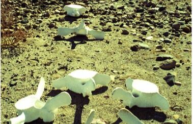
I was up early at my rocky landing spot on the Sea of Cortez south of Puertecitos and, after noting the light breeze I broke down the tent and packed the kayak. Kayaking the Sea of Cortez I had only made about 3 miles yesterday before the strong winds and dangerous waves caused me to stop for the day. The wind was north at first and then from the west. I went for about two hours and landed at a rocky beach near an old fish camp where I saw a sea turtle just offshore. He stuck his head up and gasped for air. Sea turtles make a rather loud sound as they come up and gasp for air and are probably easily noticed by fishermen who I think catch them whenever they can. This was the 6th day of my journey, and I was surprised that I had not seen any sea turtles until today. Perhaps I shouldn’t have been surprised there were so few based on the large number of turtle carapaces that I had seen washed up on the beaches where I have been camping. Sea turtles are endangered species and protected by law in Mexico, including in the Sea of Cortez. But they can get entangled in gillnets and drown and I had seen many gillnets during my first few days of travel.
I’m feeling pretty stinky after many days without a shower, so after my “brunch” I took a bath in the seawater. As I was washing, I saw a big eel about 5 feet long and 5 inches in diameter just a few feet offshore. It was kind of brown with a rounded head. I had seen many eels in California while scuba diving, but I had never seen one like that.
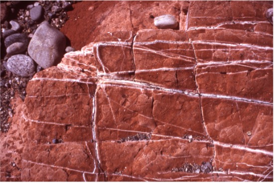
I went by a volcano identified as Volcan Prieto on my maps, a volcano that is about 1000 feet tall with high steep cliffs that plunge into the ocean. It is a huge volcano that seems to have been split in half at the ocean edge. It has a long red stripe in the center of an otherwise black cliff. It’s an impressive sight, with its steep cliffs and distinctive red stripe that plunges into the ocean. The layers of different colors and textures provide a glimpse into the history and formation of the area, and it’s amazing to see how nature can create such intricate and beautiful patterns. Later, I passed by some huge cliffs with different but interesting geology, colored layers of rock a couple of hundred feet thick. As I paddle near the shore I’m constantly peering down into the clear water to see what creatures might be there. I’m seeing more fish in the water as I get further south, but not as many as I expected. After I passed the Volcan Prieto area the sea has begun to take on a green tint, perhaps phytoplankton, and the maximum depth I could see was only about 15-20 ft.
I was now about 80 “kayak”miles south of San Felipe, and there was less evidence of homes on the shore, and almost nobody to be seen on the more rugged terrain of the shoreline. Occasionally, I would see people fishing in pots boats and I would make an effort to paddle by hand chat with them when I could. I talked to an American couple who were fishing from their boat just offshore from their well-equipped camp just south of Volcan Prieto. Later, I met a guy on the beach who was from Montana. He said he was ranching in Montana and was going broke there, so he has been subdividing his ranch and using his money to live down here in Mexico. He complained about the washboard road that he had to travel on to bring his trailer this far south of Puertecitos. Other people I talked to in this area seemed to think the road was just fine and they liked it as rough as it was because it kept most people from coming to their favorite spots. I guess it’s all relative.
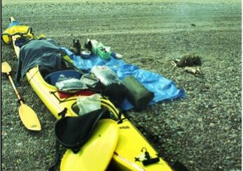
By about 5:00 PM I had made it to a small cove near Isla Huerfanito, about 19 kayak miles south of Puertecitos. I had covered about 16 miles today, making up for the short day yesterday. But I had really pushed too much, and I was very tired. I got the tent set up and I quickly had a driftwood fire going for my potatoes. My standard evening meal was potatoes and onions with salt and pepper, wrapped in foil to cook in a small fire. The potato and onion meal tastes very good, and with my appetite I never seem to get tired of it.
I thought I had enough water stored in the kayak when I was at the “Auto Parts” store in Puertecitos, but now as I sat on the beach at Isla Huerfanito thoughts are creeping into my head that maybe I didn’t have enough. I took inventory and I had 4 full bottles (about 6 liters), so I felt I had more than enough to get to Gonzaga Bay, about 30 kayak miles distant. My food supply seems good too. I have four cans of stew, three cans of fruit, two cans of peas and carrots, one can of soup and some potatoes. I figured I was about two or three days from Gonzaga Bay, so it seemed like plenty of food.
Before going to bed I checked the tide tables to see what was happening that night. The tides were building and there was going to be a 17.6-foot tide at midnight, so I had to move the tent and kayak much higher up on the beach. On these shallow beaches you must move 10 or 20 yards to gain 2 or 3 inches of elevation. I needed to figure out some kind of warning system in case the , so I don’t have to wake up in the middle and of the night. The next morning, I found I just made it with a couple of inches to spare.
Next: Day 7 – Kayaking the Sea of Cortez: Tortilla Flats
Please comment on Two Miles to the Horizon
Back to the beginning of Two Miles to the Horizon

2 Responses
[…] Next: March 10, Day 6 – Passing the Vulcan Prieto […]
[…] Day 6– Passing the Vulcan Prieto […]