
Kayaking in Sea of Cortez: This Should Be “Baja National Park” – Day 13
Checking my maps, it looked like I had gone about 151 kayak miles from my starting point at San Felipe, to my camp last night at Punta La Asamblea. I figured that I was about 35 kayak miles south of Punta Final with about 45 miles to go to Bahia de Los Angeles. As described below, while kayaking in Sea of Cortez very soon I began to think this should be “Baja Nation Park”.
In the morning there were rafts of eared grebes fishing offshore. The groups of grebes were so dense and black that the first time I saw them I thought they were the backs of whales. They all dive in unison and surface some distance away. I presume they herd schools of small fish in a coordinated attack. I saw one group that must have had 300 to 400 birds in it, all diving at once.
Most of my clothes were continually wet because of the frequent rough landings and launches so I decided to let them dry out for a while and took a walk inland through the arroyo. This was where I solved the mystery of the big fish fins that I had seen near Isla Huerfanito about a week earlier. As I walked through an area with many whalebones, I saw the fins everywhere and I finally figured out that they were not fins, they were baleen that the whales use to strain out plankton and small fish when they are feeding.
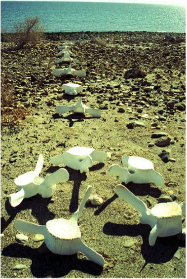
I walked for about an hour up the valley wash. There were two types of saguaro cactus here. The regular tall ones that look like a man with his arms up, and a sprawling type with bushy spines at the tip of each arm. I collected a bunch of whalebones and I made a whale bone monument with a clam shell in the middle and within the clam I left a note, “Let me wash upon your shores, I might be at the beginning, I might be at the end”.
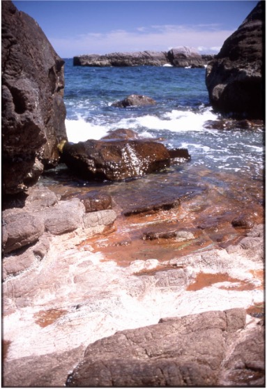
I put the kayak in the water at about 9:30 a.m. and I pulled out about 5:30 in the evening. In my journal I had written that this was the most incredible day of kayaking in Baja. After I put in at Punta La Asamblea, I went on with my sail for about one hour and then paddled for about 45 minutes. I think I covered about 4 miles. I came to an area where the shoreline was made up of incredible rock formations in the tidal zone. I landed to explore the area with my camera. The beach was awesome, and the rock formations were just unending.
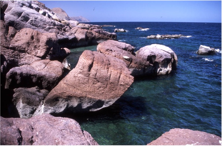
I was totally inspired by the incredible beaches and rock formations here. I said, to myself (who else?), if I were in charge, I would make this a National Park. For the next several hours I paddled along this incredible shore, and I was consumed with the idea of how there needed to be a Baja National Park and this beach just had to be the center of it. I wanted to be the John Muir of Baja, pushing to make this a National Park. I thought of letters, brochures, web sites, and a great movement to form Baja National Park. The park would have the boundaries Punto Final to Punto Remedios, about 80 miles long. To protect the eastern cliffs and slopes leading to the Sea of Cortez, the western boundary would have to be 10 km west of the drainage divide. In the Sea of Cortez, the boundary would be 1 km from the shore. I thought of all the reasons why these boundaries were essential: biological, geological, economic, and how this National Park would fit into and compliment the Harbors Plan being proposed by the Mexican government. I thought about the land ownership issues and how the fish camps could coexist with the development of a National Park.
A few miles south of Punta La Asamblea I came to a large bay and instead of hugging the shore as I normally do I took a short cut that took me across the mouth of the Bay and quite far out in the ocean. This could be quite dangerous if there was an offshore wind and was unusual for me. Fortunately, it was calm and when I was about halfway across this large bay, I spotted a dead whale on the shore. I went in close to shore to check it out. The whale was about 60 feet long and was pushed up on the beach at the high tide line. Part of its tail was missing, and the seagulls and buzzards had been working on it for a few days or weeks.
I went on and the sea became very calm and oily looking. Very nice kayaking! The water has been very blue and clear since leaving Bahia Calamajue.
As I approached a point of land called Punta El Muerto, I noticed what looked like a heavy breeze blowing northeast to southwest right near the point. When I got closer, I found it was not a breeze, but it was a wave effect caused by the collision of currents. The calm oily water turned to a band of chop and suddenly I was in choppy waves bouncing around with little white caps. After a hundred yards of these choppy waves, I was right back in calm water.
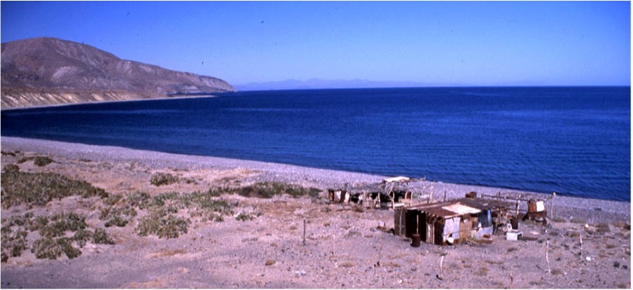
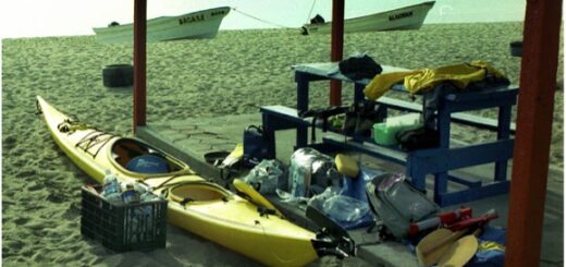
About a mile south of Punta El Muerto I found a deserted fish camp on a long sandy beach. I checked it out and took some pictures. Like most fish camps it had a small shack that was constructed from plywood and cardboard. The shack had a separate room with a makeshift cot for a bed, a barrel for a cooking fire, an old metal grill, and a refrigerator laid on its back for use as an ice box. There were no roads leading to this place and everything was brought here by panga. There were fish heads floating in the surf at the high tide line; apparently the fishermen must have been here in the last few days. They were mostly bottom fish, skates, sharks, and some ugly looking fish I didn’t recognize.
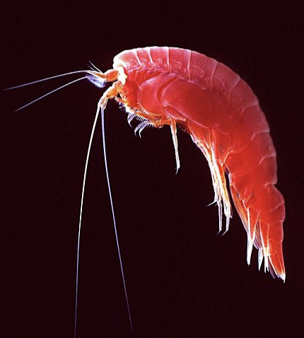
On one of my stops while taking a quick bath, I noticed a small school of amphipods swarming to me in the surf and biting my skin. This must be the local cleaning crew. I remember they were much bigger when I visited Bahia de Los Angeles some years before, but these bit me so much that it was uncomfortable to stand in the water with bare feet.
I left the fish camp at Punta El Muerto and about an hour later I landed on a small rocky beach for my overnight camp. By now it was almost dark, and I had to write up my notes quickly to beat the darkness. Before I left home, I had some thoughts about bringing some books to read, discarding that idea because of the extra weight. It seems that I really have very little time to read, especially if I’m doing 10 or 12 miles a day. I had fallen into a pattern of activity where it seemed I always had something to do: wake up, have coffee, take down the camp, pack the kayak, launch, paddle for two hours, stop for a brunch or lunch, launch and paddle for 3-5 hours stopping every hour for a break, find a good place to haul out for the evening, set up camp, have dinner, sleep.
Next is Day 14 – Canal de Ballenas & Wretched Excess
Please comment on Two Miles to the Horizon
Back to the beginning of Two Miles to the Horizon

2 Responses
[…] Day 13 – This Should Be “Baja National Park” […]
[…] Kayaking in Sea of Cortez: This Should Be “Baja National Park” – Day 13 […]